
“Rocky Mountain Photography is wonderful to work with! They create so much value with their services.I recommend Rocky Mountain Photography without reservation!”

Tell us about your professional media or project needs for a free evaluation and quote from our team today!
Quick answer
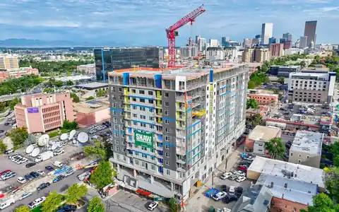
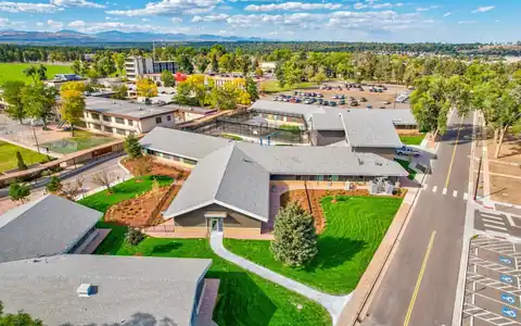
Rocky Mountain Photography coordinates fixed wing construction photography from Denver across Colorado for highways, pipelines, master-planned communities, and large industrial sites where drones alone are not practical. Licensed pilots fly crewed aircraft while our photographers capture high-altitude progress views, and we combine them with drone close-ups so owners and agencies see both scale and detail.
Fixed wing construction photography fits projects that are simply too big or too long for a drone. A highway widening that runs for miles, a pipeline corridor, a master-planned community with hundreds of lots, or an industrial campus spread across a large parcel all benefit from the altitude and range of a crewed airplane. One flight can document an entire project in a single morning.
Rocky Mountain Photography, founded in Denver in 2016 by brothers Jeff and Nick Perry, coordinates fixed-wing aerial work for developers, contractors, public agencies, and engineering firms across Colorado. Licensed pilots operate the aircraft, while our photographers handle composition and timing. Many projects pair fixed-wing context with our Part 107 drone flights, which capture close progress details on the same schedule.
Drones are limited by Part 107 rules, including altitude limits and the requirement to keep the aircraft within the pilot's visual line of sight. That works well for a single building site, but not for long or very large projects. Fixed-wing aircraft can follow a highway, rail, or pipeline corridor for miles and capture several large sites in one flight. They also reach higher altitudes for wide context views showing a project in relation to the city, the foothills, or surrounding infrastructure. Some sites near busy airports may restrict drone heights, while crewed aircraft operate under different rules and coordination with air traffic control. The tradeoff is less flexibility for close detail and hovering, which is why many projects combine both platforms, using fixed-wing for scale and drones for detail.

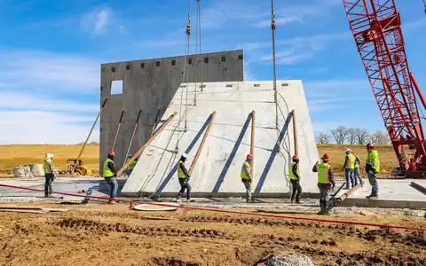
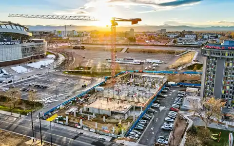
A program starts with a map of the project and the views stakeholders need. We plan a route that covers each segment or site, with consistent altitude and direction so later flights match. Weather is a major factor. Clear skies and good visibility produce the sharpest images, while haze or wildfire smoke can soften views at altitude, so we set flexible windows for each flight and confirm conditions the day before. During the flight, the photographer captures each target with several passes. After landing, images are edited for color and haze, labeled by segment or station, and delivered through an online gallery. Programs often run monthly or quarterly. Smaller sections that need close views can be added with drone construction aerials on the same schedule.

Public agencies use fixed-wing imagery to show taxpayers and officials how a road, transit, or water project is progressing. Developers of master-planned communities use it to document land development phases, from grading and utilities to streets and home construction, and to market progress to builders and buyers. Engineering firms use the imagery for coordination and reports. Industrial and energy projects document large facilities and access roads. The images also work in public meetings, investor updates, and award submissions. For housing development marketing, see housing development drone video. For general aerial photography beyond construction, see fixed-wing aerial photography. We will recommend the most efficient platform for each part of your project. Share how the images will be presented, and we will plan angles that read clearly on a slide or a printed board.




















“Rocky Mountain Photography is wonderful to work with! They create so much value with their services.I recommend Rocky Mountain Photography without reservation!”

“If you're looking for the BEST photography company to work with, you've found it at Rocky Mountain Photography! Our company had so much fun getting our head shots taken! Jeff really knows how to get an authentic expression by making the experience fun! We love our pictures!”

Rocky Mountain Photography was absolutely wonderful to work with. We used several of their studio spaces, black cyc wall, white cyc wall, and green screen audio room, to shoot photo and video for our adaptive wheelchair apparel launch. We look forward to shooting with them again in the future!

Rocky Mountain Photography provided an extraordinary service to our corporate events. They captured fantastic photos of our speakers, exhibitors, and sponsored events. They were also creative and went above and beyond what was specifically requested. We’ve hired them several times and would highly recommend them to any event organizer looking for professional high quality media.

“Great service, quality, and speed. In addition to being a great photographer, Jeff is also a great guy to work with. Thanks again man!”

“Our brokerage has sold millions of dollars of commercial real estate across Colorado. Rocky Mountain Photography has been an excellent partner of ours, creating high quality professional media to showcase these various investment properties. They’re consistently reliable, communicative and on-time.”

Had an awesome time working with Rocky Mountain Photography on a shoot! Great communication through the whole process, excellent attention to detail. Would love to work with them again!

“Rocky Mountain Photography is a fantastic business! We used them for professional property photos for two of our commercial properties and were very satisfied with their work and help. They are very responsive, reasonable and talented. The pictures were exactly what we needed to effectively market our properties!”

“Great and thoroughly professional experience.. Quality, timeliness, delivery, and accounting were all best in class. Above and beyond service, can’t wait to work with this team again.”
Fast, Reliable & Professional Aerial Photography, Video, Virtual Media & Custom Videos for the Real Estate & Construction Professional Across the World

Scheduling made simple. Use our user-friendly website for online booking or connect with project managers for personalized service—because your time matters

Time is of the essence! Count on us for next-day delivery, adding speed and excellence to your commercial, drone, and residential projects.

With coast to coast coverage, we offer professional nationwide drone, photo, and video coverage, capturing properties and projects wherever you need!

Customer satisfaction is at the core of our business philosophy at Rocky Mountain Photography. We’ll always go the extra mile to deliver exceptional quality and beautiful media for our clients.

Trust our video expertise for creating visually stunning service videos, credible testimonial videos, and tailored training video production to meet your needs.

Serving hundreds of businesses and thousands of clients, Rocky Mountain Photography is a trusted choice for exceptional photography, video, & drone services.

Our process begins with a detailed understanding of your project, followed by the assignment of a dedicated project manager. We then determine the ideal package to meet and exceed your media needs.

Once your project needs are understood, our team schedules and captures your photography, video, or drone media professionally from ground and sky, making sure to include all client specifications and instructions.

Upon completion, we meticulously edit and upload the media for your review, providing any necessary updates or revisions before sending the final high-resolution deliverables to you on time and on budget.
It is progress photography captured from a crewed airplane rather than a drone. It suits long corridors and very large sites because the aircraft can cover miles in one flight and reach higher altitudes for wide context views across Colorado.
Only for very large or linear projects. Most single building sites are better served by drones, which fly closer and capture detail. Highways, pipelines, and master-planned communities often benefit from fixed-wing, sometimes combined with drone flights.
Licensed pilots operate the aircraft, and our photographer focuses on capturing the images. We coordinate the route, targets, and timing so flight time is used efficiently and later flights match earlier ones. Drone portions are flown by our Part 107 pilots.
Monthly or quarterly is common, depending on the pace of work and reporting needs. Flexible weather windows are built into each flight because clear visibility matters more at altitude than for low drone flights near Denver.
Yes. Fixed-wing covers the full extent of a large project, while drones capture close details at active areas. Combining both on a shared schedule gives stakeholders scale and detail in one report. Reports stay consistent too.
Request a quote with a map of the project extent, the views needed, the reporting schedule, and the start date. We will recommend fixed-wing, drone, or both and plan the first flight. A KML of the corridor helps.