Drone Imaging in Denver, CO

Quick answer

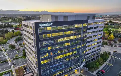
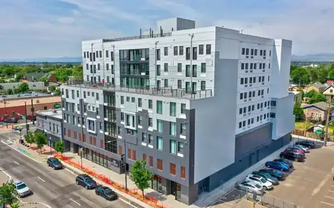
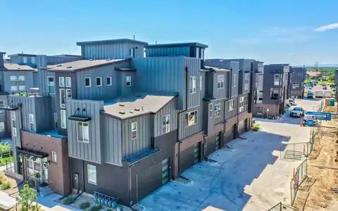
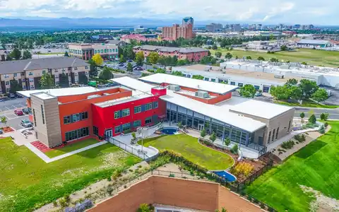
Rocky Mountain Photography provides drone imaging in Denver for documentation, marketing, and project records. Our Part 107-certified, insured pilots capture high-resolution aerial stills and short clips of buildings, land, job sites, and infrastructure, with airspace authorization checked before every flight. Images arrive edited and organized for reports, websites, insurance files, and presentations, with drone imagery hosting included.

Drone imaging in Denver covers a wide middle ground between marketing photography and technical mapping. Sometimes a team just needs clear, current aerial images of a site: what the property looks like today, where the trucks are staged, how the retaining wall was finished, or what a parcel looked like before work started. Those images need to be accurate, well organized, and easy to share.

Rocky Mountain Photography, founded in Denver in 2016 by brothers Jeff and Nick Perry, captures this kind of practical aerial imagery for property managers, contractors, insurers, attorneys, and owners. We focus on consistent angles, clear labeling, and honest images, so the files hold up as a record and not just as pretty pictures.

Documentation imaging for property and projects

Documentation imaging is about completeness and repeatability. For a property record, we capture every elevation, the roof, parking areas, landscaping, and access points, labeling each image by location. For contractors, we document site conditions before mobilization, after major milestones, and at closeout. Insurance and legal teams use aerial images to record conditions after storms, accidents, or disputes, where accurate dates and consistent views matter. We log the date and time of each flight and avoid edits that change what is shown, beyond basic color and exposure correction. When a project needs the same angles repeated later, we note takeoff points and headings so future flights can match. This kind of record also helps owners compare conditions year over year when planning maintenance or capital improvements.

Real Estate Photography in Denver, Colorado

Marketing and presentation imaging

Some imaging projects lean toward presentation. Owners and developers want aerial images for investor decks, board meetings, website project pages, and grant applications. Here we still prioritize accuracy, but we also pay attention to light, composition, and clean framing. A morning flight with low sun can bring out texture in terrain and buildings, while a top-down image can make a site plan easy to understand. We can add simple labels, arrows, or outlines based on information you provide, such as building names or phase boundaries. For listing-grade or brand photography, our aerial drone photography service puts even more emphasis on creative editing. For detailed technical review of facades or structures, our inspection services are a better fit. Tell us the audience, and we will frame the images for that room.

Real Estate Photography in Denver, Colorado

Formats, delivery, and when to choose mapping

Imaging deliverables are high-resolution JPEGs, with web-ready versions for email and reports, and short MP4 clips when motion helps explain a site. Files are delivered through an online gallery or shared link, organized by date and location, and imagery hosting is included with drone packages. If your team needs to measure distances, areas, or volumes, standard images are not enough. A planned mapping flight produces a scaled orthomosaic or 3D model through our drone data processing workflow, and GIS imagery can be delivered in your coordinate system. We will help you decide which approach fits when you share what the images need to support. A short call usually settles the question quickly.

Commercial Real Estate Packages for Brokers - Rocky Mountain Photography

Video examples

Drone inspection reel
Residential hail inspection by drone
Drone aerial reel

Gallery

GALLERY EXAMPLES

Denver Drone Video Examples

Commercial Office Sales Video
Commercial Property Drone Sales Video
Multifamily Leasing Video
New Mexico Multifamily Sales Video
Industrial Property Animated Video
Seattle Multifamily Property Video

Trusted By

HinesCBRECollierseXp Realty5280 MagazineBerkadiaBryan ConstructionDaVita Kidney CareDCPS Denver Commercial Property ServicesAmaconMarcus & MillichapMcWhinneyShaw ConstructionMurray & StaffordCushman & WakefieldDenver BroncosD.R. HortonDenver Metro Chamber of Commerce

Testimonials

Shawn T.★★★★★

“Rocky Mountain Photography is a fantastic business. We used them for professional property photos for two of our commercial properties and were very satisfied with their work and help. The pictures were exactly what we needed to effectively market our properties. Thank you!”

Shawn T.

Anne B.★★★★★

“Always do a fantastic job on my RE Listing photos and video. Great drone video and Twilight shots.”

Anne B.

Dorota M.★★★★★

“Super friendly and professional. Photos turned out great. Can't recommend highly enough.”

Dorota M.

Ben S.★★★★★

“Our brokerage has sold millions of dollars of commercial real estate across Colorado. Rocky Mountain Photography has been an excellent partner of ours, creating high quality professional media to showcase these various investment properties. They're consistently reliable, communicative and on-time.”

Ben S.

Sam M.★★★★★

“Rocky Mountain Photography are experts in their craft and offer a wide range of services, including drone and twilight photography, videos with graphics, and lightning-fast delivery times. Thev are responsive, professional, and always go above and beyond to ensure that the final product exceeds expectations.”

Sam M.

Edy G.★★★★★

“I met these guys at a CREJ conference and I am very impressed with their aerial and drone work & very happy with the results.”

Denver Drone Aerial, Photography, & Video Services

Fast, Reliable & Professional Aerial Photography, Video, Virtual Media & Custom Videos for the Real Estate & Construction Professional Across the World

Easy Booking & Scheduling

Scheduling made simple. Use our user-friendly website for online booking or connect with project managers for personalized service—because your time matters

Efficient & Rush Delivery

Time is of the essence! Count on us for next-day delivery, adding speed and excellence to your commercial, drone, and residential projects.

National Coverage

With coast to coast coverage, we offer professional nationwide drone, photo, and video coverage, capturing properties and projects wherever you need!

Satisfaction Guaranteed

Customer satisfaction is at the core of our business philosophy at Rocky Mountain Photography. We’ll always go the extra mile to deliver exceptional quality and beautiful media for our clients.

Complete Video Services

Trust our video expertise for creating visually stunning service videos, credible testimonial videos, and tailored training video production to meet your needs.

Trusted by Thousands

Serving hundreds of businesses and thousands of clients, Rocky Mountain Photography is a trusted choice for exceptional photography, video, & drone services.

How It Works

1. Tell us about your project

Our process begins with a detailed understanding of your project, followed by the assignment of a dedicated project manager. We then determine the ideal package to meet and exceed your media needs.

2. We Capture the Media

Once your project needs are understood, our team schedules and captures your photography, video, or drone media professionally from ground and sky, making sure to include all client specifications and instructions.

3. Receive your Deliverables

Upon completion, we meticulously edit and upload the media for your review, providing any necessary updates or revisions before sending the final high-resolution deliverables to you on time and on budget.

Frequently asked questions

What is drone imaging?

Drone imaging is high-resolution aerial photography and short video captured for documentation, presentation, or project records. It shows current conditions clearly without the measurement processing that mapping requires, making it faster and simpler for many uses.

Can drone images be used as evidence or for insurance claims?

Many teams use them to document conditions. We record flight dates, avoid edits that change what is shown, and organize images clearly. Whether images are accepted for a specific claim or case is up to your adjuster or attorney.


How is drone imaging different from drone mapping?

Imaging produces photos and video to look at. Mapping produces measurable, georeferenced products such as orthomosaics and 3D models. If you need distances, areas, or volumes, choose a mapping flight instead of standard images. We can explain the difference in a quick call.

Can you repeat the same views later?

Yes. We note takeoff points, heights, and headings so later flights can match earlier angles. That consistency makes before-and-after comparisons straightforward for owners, contractors, and insurers around Denver. It also keeps the record useful for long projects and future maintenance planning.

How fast will I receive drone images?

Next-day delivery is available on many photo shoots. Projects with many locations, labels, or video edits may take longer, and we confirm the date when booking so your report or presentation stays on schedule. Rush needs can be discussed.

How do I schedule drone imaging in Denver?

Request a quote with the site address, what the images need to show, and your deadline, or book online. We will check airspace authorization and recommend angles before the flight. We also send simple prep notes so the site looks its best.

Call