
Broker Packages
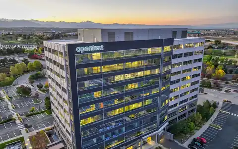
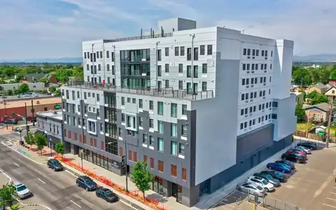
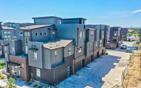
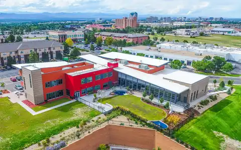
Our drone photo and video services are guaranteed to elevate your commercial listing and help create beautiful offering memorandums to sell at top dollar.

Tell us about your professional media or project needs for a free evaluation and quote from our team today!
Quick answer
Rocky Mountain Photography provides aerial drone photography Denver, Colorado clients use across the metro, from downtown and Cherry Creek to the Denver Tech Center, Aurora, Lakewood, Westminster, Boulder, and mountain towns. Our Part 107-certified pilots check airspace before every flight, since many areas fall near controlled airspace, and deliver edited aerials for commercial clients.
Searching for aerial Denver services usually comes with a location in mind: an office in the Tech Center, a retail center in Aurora, an industrial park near the airport, or a development site in the northern suburbs. Each area has its own character and its own airspace considerations, and a provider who knows the metro can plan the right shots and approvals without wasted time.
Rocky Mountain Photography, founded in Denver in 2016 by brothers Jeff and Nick Perry, flies aerial photography and video throughout the Front Range and Colorado. Our pilots are Part 107-certified and insured, and they check airspace before every flight. That matters here, because parts of the metro sit near Denver International, Centennial, Rocky Mountain Metropolitan, and Buckley Space Force Base.
Different submarkets call for different shots. Downtown and LoDo projects need views that show transit, the skyline, and nearby amenities, with careful planning around tall buildings and crowds. Cherry Creek properties benefit from context showing retail, dining, and the creek trail. The Denver Tech Center and southeast suburbs feature office campuses near I-25, where aerials show access, parking, and nearby light rail stations. Industrial areas near I-70 and I-76 and around the airport call for truck court and access views. Northern suburbs like Westminster, Thornton, and Broomfield have newer developments and land where context and boundaries matter. West-side areas like Lakewood and Golden put the foothills in the background, which makes for striking context aerials. We adapt every shot list to the location and property type.

Airspace is the biggest variable in Denver aerial work. Controlled airspace surrounds Denver International, Centennial, Rocky Mountain Metropolitan, and other airports, and military activity at Buckley Space Force Base adds its own considerations. Pilots check authorization before every flight and request it through LAANC when available, which often allows approval quickly for permitted heights. Some locations have low height limits or cannot be approved through automated systems, and those may need more lead time or a different approach. Temporary flight restrictions, such as those around stadium events or VIP visits, can also affect schedules. We tell you early if a site has constraints, suggest alternative angles or heights, and schedule around approvals. Weather is the other variable, and we watch forecasts closely and reschedule early when needed.

Many commercial clients have properties outside Denver. We fly in Boulder, Fort Collins, Colorado Springs, mountain resort towns, and rural areas across Colorado, planning travel, weather windows, and airspace for each. Mountain properties bring stunning backdrops but also wind, rapid weather changes, and thin air that affects flight time, so pilots plan conservatively. Rural land and agricultural properties often need wide context views and boundaries from survey data. Deliverables are the same wherever we fly: edited, web-ready and full-resolution images, with annotated versions and video when requested, and next-day delivery available on many photo shoots. For more on commercial aerials, see commercial drone photography. For construction sites, see construction aerial photography, and for wide-area flights, see fixed-wing aerial photography. Wherever the property sits, the planning and quality standards stay the same.




















Our drone photo and video services are guaranteed to elevate your commercial listing and help create beautiful offering memorandums to sell at top dollar.

When our clients need beautiful visuals to showcase their portfolio or stand out in the market - they utilize our professional drone photography for their property.

Our drone operators provide beautiful 4k aerial video of properties, projects, & listings. From animated property videos to raw clips, we're ready to deliver!

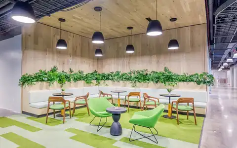
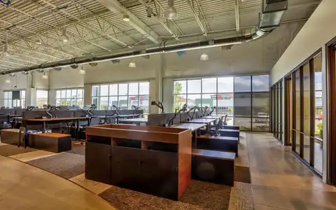
With our photography packages designed to impress, you can count on our team to showcase your commerical property's essence professionally.

With our drone services ranging from aerial imagery to precise scanning, mapping, and LiDAR - you can rely on our team to create the media you need.

We craft visual narratives and property videos that professionally showcase commercial properties and mostly importantly, that sell at top dollar.

Using modern day matterport cameras & LiDAR services, our commercial photographers & tour creators are able to scan and map your property.

Our team uses this premium photography & video service and time of day to balance artificial and ambient light & give any property a breathtaking glow.

Using a process called high dynamic range (HDR), we layer exposures together to guarantee the final images come out exceptional and vibrant.

“Rocky Mountain Photography is a fantastic business. We used them for professional property photos for two of our commercial properties and were very satisfied with their work and help. The pictures were exactly what we needed to effectively market our properties. Thank you!”

“Always do a fantastic job on my RE Listing photos and video. Great drone video and Twilight shots.”

“Super friendly and professional. Photos turned out great. Can't recommend highly enough.”

“Our brokerage has sold millions of dollars of commercial real estate across Colorado. Rocky Mountain Photography has been an excellent partner of ours, creating high quality professional media to showcase these various investment properties. They're consistently reliable, communicative and on-time.”

“Rocky Mountain Photography are experts in their craft and offer a wide range of services, including drone and twilight photography, videos with graphics, and lightning-fast delivery times. Thev are responsive, professional, and always go above and beyond to ensure that the final product exceeds expectations.”

“I met these guys at a CREJ conference and I am very impressed with their aerial and drone work & very happy with the results.”
Fast, Reliable & Professional Aerial Photography, Video, Virtual Media & Custom Videos for the Real Estate & Construction Professional Across the World

Scheduling made simple. Use our user-friendly website for online booking or connect with project managers for personalized service—because your time matters

Time is of the essence! Count on us for next-day delivery, adding speed and excellence to your commercial, drone, and residential projects.

With coast to coast coverage, we offer professional nationwide drone, photo, and video coverage, capturing properties and projects wherever you need!

Customer satisfaction is at the core of our business philosophy at Rocky Mountain Photography. We’ll always go the extra mile to deliver exceptional quality and beautiful media for our clients.

Trust our video expertise for creating visually stunning service videos, credible testimonial videos, and tailored training video production to meet your needs.

Serving hundreds of businesses and thousands of clients, Rocky Mountain Photography is a trusted choice for exceptional photography, video, & drone services.

Our process begins with a detailed understanding of your project, followed by the assignment of a dedicated project manager. We then determine the ideal package to meet and exceed your media needs.

Once your project needs are understood, our team schedules and captures your photography, video, or drone media professionally from ground and sky, making sure to include all client specifications and instructions.

Upon completion, we meticulously edit and upload the media for your review, providing any necessary updates or revisions before sending the final high-resolution deliverables to you on time and on budget.
The entire metro, including downtown, Cherry Creek, the Denver Tech Center, Aurora, Lakewood, Golden, Westminster, Thornton, Broomfield, and surrounding suburbs, plus Boulder, Fort Collins, Colorado Springs, and mountain and rural areas across Colorado. Ask about any location.
Yes. Areas near Denver International, Centennial, Rocky Mountain Metropolitan, and Buckley Space Force Base have controlled airspace with height limits. We check authorization before every flight and tell you early if a site needs extra lead time.
Travel needs are included in the quote for locations outside the metro. Share the address when requesting a quote, and we will confirm travel, scheduling, and any weather or airspace considerations for that location. No hidden extras.
Yes. Mountain properties are popular, though wind and weather change quickly at altitude. Pilots plan conservative flights and flexible schedules, and we check airspace and any local restrictions before each flight. Backup dates help a lot.
Edited, web-ready and full-resolution images, annotated aerials when requested, and video clips or edits as needed. Next-day delivery is available on many photo shoots, with annotations and video on agreed dates. Files are organized by area.
Request a quote with the property address, type, and the views you need, or book online. We will check airspace for that location and confirm scheduling. Include any access instructions, gate codes, or contact names so the pilot can get started quickly on site.