
Broker Packages
Our drone photo and video services are guaranteed to elevate your commercial listing and help create beautiful offering memorandums to sell at top dollar.

Tell us about your professional media or project needs for a free evaluation and quote from our team today!
Quick answer
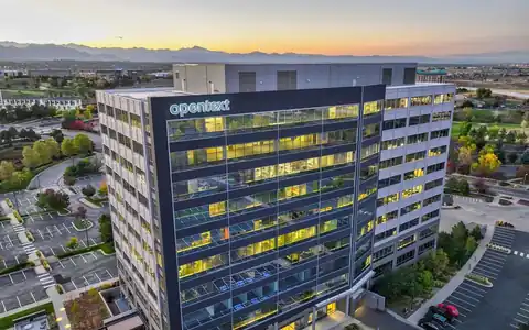
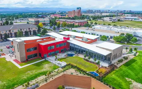
As an aerial photographer Denver, Colorado brokers call for large commercial portfolios, Rocky Mountain Photography coordinates fixed-wing flights over business parks, master-planned developments, and submarkets. Licensed pilots fly crewed aircraft at altitudes drones cannot reach, while our photographers capture wide context images for brokers, developers, and economic development teams, often paired with Part 107 drone close-ups.
Denver aerial photography for commercial real estate sometimes needs a bigger view than a drone can provide. A broker marketing a large business park, a developer presenting a master-planned community, an economic development group showing a corridor, or an owner documenting a multi-site portfolio may need images taken from higher altitudes and covering many properties in a single flight. That is where a crewed fixed-wing aircraft can help.
Rocky Mountain Photography, founded in Denver in 2016 by brothers Jeff and Nick Perry, coordinates fixed-wing aerial work for commercial clients across Colorado. Licensed pilots operate the aircraft, while our photographers focus on composition, light, and capturing each target efficiently. For close views of individual buildings, our Part 107-certified drone pilots handle the detail work, so each project gets the right platform.
Fixed-wing photography suits commercial projects where scale and context matter most. Submarket overviews show a property within an entire employment center, such as the Denver Tech Center, the I-25 corridor, or the airport area. Large business parks and industrial campuses can be captured in their entirety. Master-planned developments, with many parcels and phases, are best understood from altitude. Portfolio owners with Colorado properties spread across the metro can photograph several sites in one flight. Economic development organizations use high-altitude images to market regions to employers. Fixed-wing flights also work in areas where drone heights are limited by airport airspace, since crewed aircraft operate under different rules and coordination with air traffic control. For most single-building listings, though, a drone remains faster and more economical.

We start with a list of targets and the views each needs, then plan a route that captures them efficiently with consistent altitude and direction. Weather is critical at altitude. Clear skies and good visibility make the sharpest images, while haze, smoke, or high clouds soften the view, so we set flexible flight windows and confirm conditions the day before. Morning flights often offer the clearest air and calmer conditions along the Front Range. During the flight, the photographer shoots each target with several passes and lenses. After landing, images are edited for color, clarity, and haze, and we can add annotations such as property outlines, labels, and landmark callouts using documents you provide. Files are delivered as full-resolution and web-ready images through an online gallery.

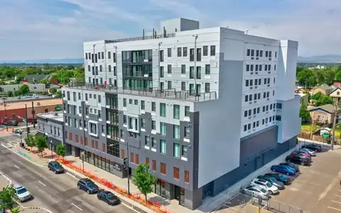
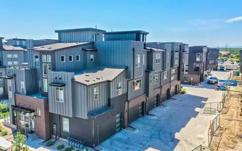
Many commercial projects benefit from both platforms. A fixed-wing flight captures the big picture, such as the full extent of a business park or a property's place in the metro, while drone flights capture each building's facade, parking, and loading up close. Combining both gives brokers and developers a complete set: context for the first page of an offering memorandum and detail for the pages that follow. Drone flights are covered on our commercial drone photography and aerial photography by area pages, and construction projects can use both through construction aerial photography. For general fixed-wing work beyond commercial real estate, see our fixed-wing aerial photography company page. We recommend the right mix after reviewing your targets and goals. Planning both together also keeps the color and editing style consistent across the whole set.




















Our drone photo and video services are guaranteed to elevate your commercial listing and help create beautiful offering memorandums to sell at top dollar.

When our clients need beautiful visuals to showcase their portfolio or stand out in the market - they utilize our professional drone photography for their property.

Our drone operators provide beautiful 4k aerial video of properties, projects, & listings. From animated property videos to raw clips, we're ready to deliver!

With our photography packages designed to impress, you can count on our team to showcase your commerical property's essence professionally.

With our drone services ranging from aerial imagery to precise scanning, mapping, and LiDAR - you can rely on our team to create the media you need.

We craft visual narratives and property videos that professionally showcase commercial properties and mostly importantly, that sell at top dollar.

Using modern day matterport cameras & LiDAR services, our commercial photographers & tour creators are able to scan and map your property.

Our team uses this premium photography & video service and time of day to balance artificial and ambient light & give any property a breathtaking glow.

Using a process called high dynamic range (HDR), we layer exposures together to guarantee the final images come out exceptional and vibrant.

“Rocky Mountain Photography is a fantastic business. We used them for professional property photos for two of our commercial properties and were very satisfied with their work and help. The pictures were exactly what we needed to effectively market our properties. Thank you!”

“Always do a fantastic job on my RE Listing photos and video. Great drone video and Twilight shots.”

“Super friendly and professional. Photos turned out great. Can't recommend highly enough.”

“Our brokerage has sold millions of dollars of commercial real estate across Colorado. Rocky Mountain Photography has been an excellent partner of ours, creating high quality professional media to showcase these various investment properties. They're consistently reliable, communicative and on-time.”

“Rocky Mountain Photography are experts in their craft and offer a wide range of services, including drone and twilight photography, videos with graphics, and lightning-fast delivery times. Thev are responsive, professional, and always go above and beyond to ensure that the final product exceeds expectations.”

“I met these guys at a CREJ conference and I am very impressed with their aerial and drone work & very happy with the results.”
Fast, Reliable & Professional Aerial Photography, Video, Virtual Media & Custom Videos for the Real Estate & Construction Professional Across the World

Scheduling made simple. Use our user-friendly website for online booking or connect with project managers for personalized service—because your time matters

Time is of the essence! Count on us for next-day delivery, adding speed and excellence to your commercial, drone, and residential projects.

With coast to coast coverage, we offer professional nationwide drone, photo, and video coverage, capturing properties and projects wherever you need!

Customer satisfaction is at the core of our business philosophy at Rocky Mountain Photography. We’ll always go the extra mile to deliver exceptional quality and beautiful media for our clients.

Trust our video expertise for creating visually stunning service videos, credible testimonial videos, and tailored training video production to meet your needs.

Serving hundreds of businesses and thousands of clients, Rocky Mountain Photography is a trusted choice for exceptional photography, video, & drone services.

Our process begins with a detailed understanding of your project, followed by the assignment of a dedicated project manager. We then determine the ideal package to meet and exceed your media needs.

Once your project needs are understood, our team schedules and captures your photography, video, or drone media professionally from ground and sky, making sure to include all client specifications and instructions.

Upon completion, we meticulously edit and upload the media for your review, providing any necessary updates or revisions before sending the final high-resolution deliverables to you on time and on budget.
When the project needs high-altitude context, covers a very large area, or includes many sites across the metro. Business parks, master-planned developments, and portfolio overviews are common examples. Single buildings are usually better served by drones.
Licensed pilots operate the fixed-wing aircraft, and our photographer focuses on capturing the images. We plan the route and targets together so the flight is efficient and each property is photographed from the right angle.
Yes. Grouping properties into a single route is a major advantage of fixed-wing work. Share all addresses in advance, and we will plan an efficient path across the Denver metro or Colorado. It often saves time.
Yes. Clear skies and good visibility produce the best results. Haze and smoke can soften images at altitude, so we set flexible windows and confirm conditions the day before each flight. Morning flights often help.
Yes. We add property outlines, labels, and landmark callouts using documents you provide. Annotated images are popular in offering memorandums, investor presentations, and economic development materials. Accuracy depends on the source documents you provide, so we label anything approximate clearly.
Request a quote with the list of properties or the area, the views you need, and your deadline. We will recommend fixed-wing, drone, or both and plan the flight. A simple map with targets marked is the best starting point for planning.